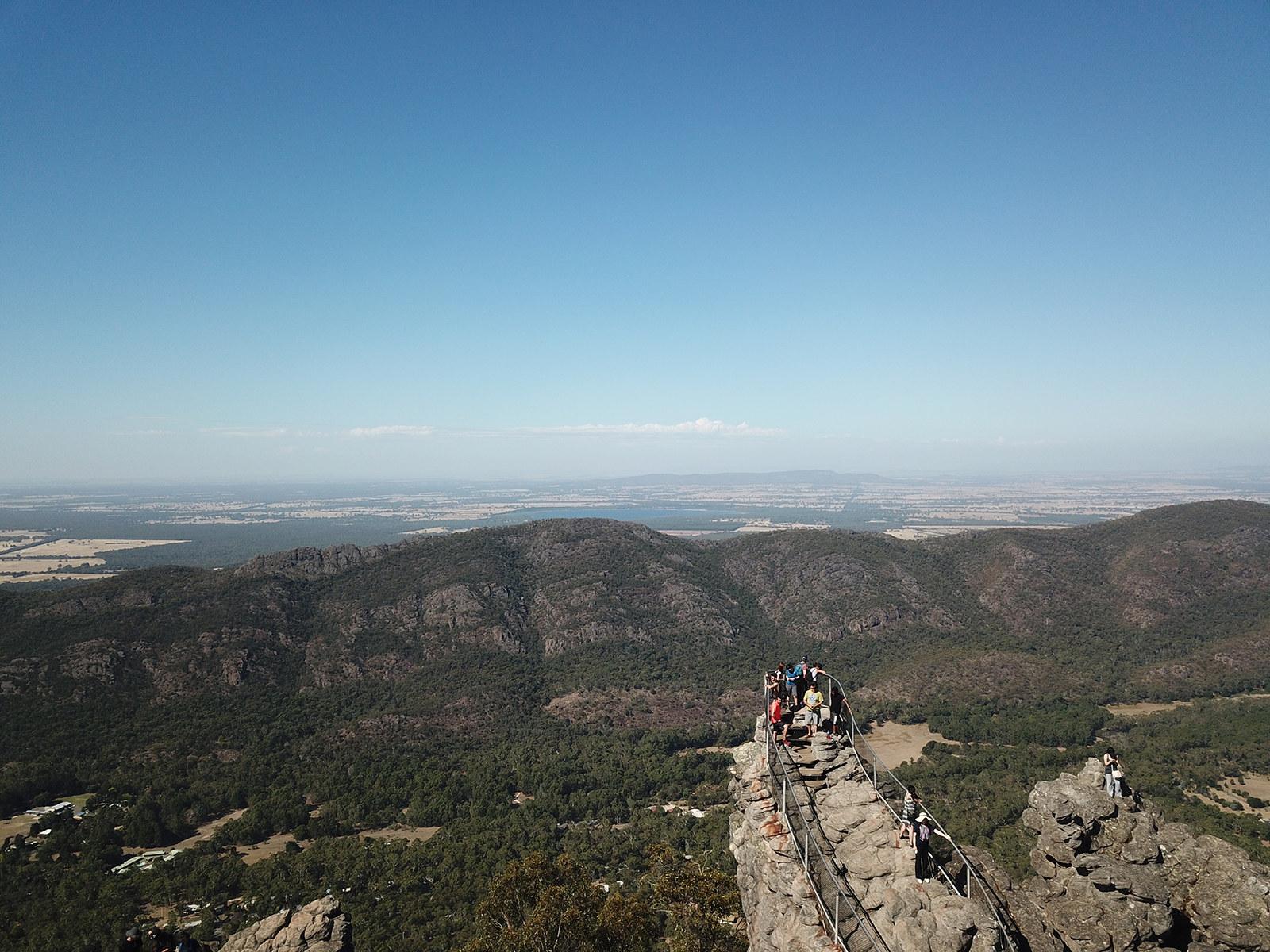
The best walks near Dunkeld
The three peaks above Dunkeld are the best short walks in the Southern Grampians. Halls Gap draws most of the Grampians crowds, but the southern end of the park is quieter, with big sandstone cliffs and views across the volcanic plains of the Western District.
Mt Abrupt (Mud-dadjug), Mt Sturgeon (Wurgarri) and The Piccaninny (Bainggug) can each be walked in half a day or less. Dunkeld is 32 km and about 25 minutes east of Hamilton, and the trailheads are a few minutes’ drive beyond town. All three peaks are also part of the Grampians Peaks Trail, which finishes in Dunkeld.
Which walk is right for you? Walk Distance (return) Time Grade Best for The Piccaninny (Bainggug) 2.5 km About 1 hr 3 (Moderate) Older kids, casual walkers, spring wildflowers Mt Sturgeon (Wurgarri) 7 km About 3 hrs 4 (Hard) Fit walkers, views over Dunkeld and the plains Mt Abrupt (Mud-dadjug) 6.5 km About 3 hrs 4 (Hard) Fit walkers, the highest summit in the south
Times are Parks Victoria estimates for a steady pace. Allow extra time for photos and breaks.
1. The Piccaninny (Bainggug): the easy option
The Piccaninny is the shortest of the three and the best choice if you have older children or only an hour to spare. The track climbs through open forest of hakea, grevillea and banksia, which puts on a strong wildflower display in spring. A few steeper sections are rocky and uneven, so wear proper shoes.
From the top, you look straight across to the cliffs of Mt Abrupt and down over the town of Dunkeld. It’s also a good walk for sunset.
Trailhead: The Piccaninny car park, off Grampians Road just north of Dunkeld.
2. Mt Sturgeon (Wurgarri): the southern anchor
Mt Sturgeon stands at the southernmost point of the Grampians National Park, and its ridged face is the backdrop to Dunkeld. The 7 km return walk climbs about 375 m through open woodland with Grampians gums, then over rocky outcrops and short steep sections as you near the top.
Watch for the false summit. When you think you’ve arrived, keep going a little further to reach the true summit, with views over the surrounding ranges, the volcanic plains and the town below. Shade is limited, so carry plenty of water and avoid hot afternoons.
Trailhead: The Mt Sturgeon car park on Victoria Valley Road, opposite the Grampians Road turn-off, about 3 km from the centre of Dunkeld.
3. Mt Abrupt (Mud-dadjug): the big climb
Mt Abrupt is the highest peak at the southern end of the Grampians and the most demanding of the three walks. The track wastes no time, winding steeply through bushland and up over sandstone rock to the summit.
From the top, you see the Serra Range stretching north and Dunkeld and the plains to the south. On a clear day, it’s one of the best views in western Victoria.
Trailhead: The Mud-dadjug (Mt Abrupt) car park, on the east side of Grampians Road, about 4 km north of the Victoria Valley Road intersection.
Want more? From the same car park, a 7.8 km return walk leads to Signal Peak (allow 3–4 hours).
Can you do more than one walk in a day?
Yes. Many walkers pair The Piccaninny with Mt Sturgeon or Mt Abrupt in a single day, since the trailheads are only minutes apart. Doing both Mt Abrupt and Mt Sturgeon in one day is a big effort, so most people spread them over two days, which makes a weekend stay in the area worthwhile.
Before you go
- Check track conditions. Southern Grampians tracks can close on high fire danger days, during bushfires and for planned burns. Check the Parks Victoria “Change of Conditions” page for Grampians (Gariwerd) National Park on the morning of your walk.
- Leave the dog at home. Dogs aren’t allowed on walking tracks in the national park.
- Pick your season. Spring brings wildflowers and mild temperatures. Autumn is also excellent. Summer can be very hot on exposed rock.
- Be prepared. Grade 4 walks include steep sections, rock hopping and slippery surfaces. Wear sturdy shoes, and carry water, a jacket and a charged phone. Mountain weather can change quickly.
- Respect Country. These peaks lie on the traditional lands of the Djab Wurrung and Jardwadjali peoples. Stay on marked tracks and take your rubbish with you.
Your base for Southern Grampians walks
Lake Hamilton Motor Village & Caravan Park is at 8 Ballarat Road, on the Dunkeld side of Hamilton. You can be at the trailheads in under 30 minutes, then return to a quieter town with supermarkets, cafes and restaurants.
- Self-contained cabins
- Powered and unpowered caravan and camping sites
- Outdoor swimming pool for tired legs
- Free barbecues and Wi-Fi
Book your Southern Grampians walking base at lakehamilton.com.au or call (03) 5572 3855.
Frequently asked questions What is the easiest walk in the Southern Grampians?
The Piccaninny (Bainggug). It is a 2.5 km return walk of about an hour, with views of Mt Abrupt and Dunkeld from the top.
How hard is the Mt Abrupt walk?
It is a Grade 4 (hard) walk of 6.5 km return, taking about 3 hours. The track is steep and rocky the whole way up, so it suits fit walkers.
How long does it take to climb Mt Sturgeon?
About 3 hours for the 7 km return walk. Watch for the false summit near the top.
Can I take my dog on Grampians walks?
No. Dogs aren’t allowed on walking tracks in Grampians National Park.
How far is Dunkeld from Hamilton?
About 32 km, or 25 minutes’ drive east along the Glenelg Highway.
Share this post:
Ready to Experience the Southern Grampians?
Book your stay at Lake Hamilton Motor Village — the perfect base for exploring everything in this guide.